Chasing Arizona’s Illusive Chocolate Falls
Note: click all photographs for a larger view. Photo credit: Michael Wilson Photography
Arizona’s Grand Falls, also known as Chocolate Falls, is one of those illusive spectacles of nature that requires you bend to her timetable if you desire to see her in all of her glory.
Located 40 miles northeast of Flagstaff, the Grand Falls is certainly one of the great unknown wonders of Arizona. She’s tucked away in the Painted Desert, on Navajo Nation lands, and can only be found if you know exactly when and where to find her.
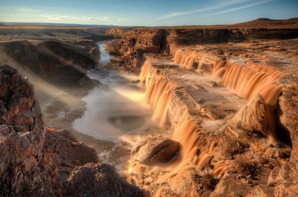
 “At 185 feet, Grand falls is higher than Niagara Falls and is known to many as “Chocolate Falls” because of its muddy color. The enormous waterfall was created when lava from a nearby volcanic eruption poured down into the canyon and blocked the river’s course, causing the water to seek a new path around the lava dam until it found its way back down into its original canyon; forming this waterfall in the process. The best time to see the falls is after snow melt in the early spring, or after a summer thunderstorm.” (via Navajo Tourism)
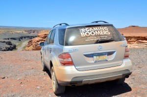
We just returned from a short northern Arizona road trip with great friends visiting from Michigan. While planning to find ourselves “standing on the corner in Winslow, Arizona“, I thought we should also drive out to the Grand Falls to see if we might witness this marvel for ourselves.
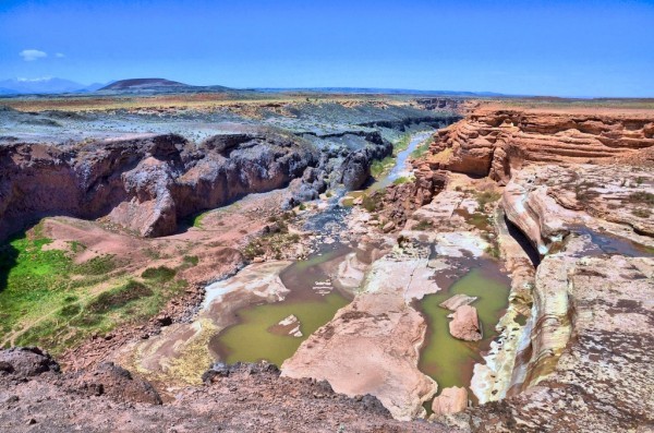
Sadly, we missed the spectacle as the bulk of the snow melt had already made its way through before our visit on May 1st. Here is what we witnessed upon our visit:
While still a beautiful site, we were disappointed that we had missed the ravenous beauty of the flowing snow melt pictured in Michael Wilson’s beautiful photograph.
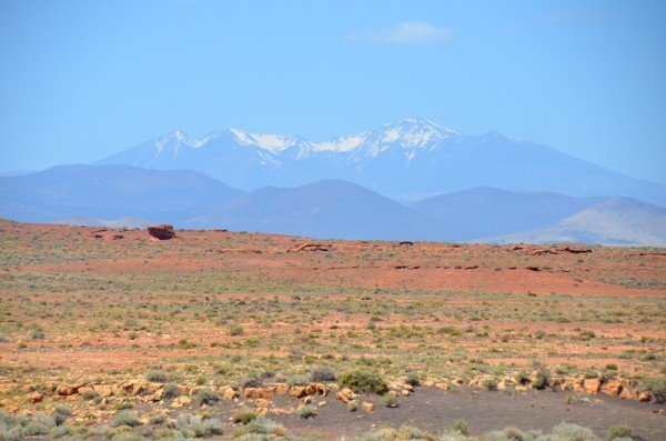
Nonetheless, we greatly enjoyed the long-range views of the distant San Francisco peaks in Flagstaff.
Irrespective of our bad timing, if you find yourself roaming through northern Arizona between March and April, we highly recommend that you journey on the road less traveled to gaze upon Arizona’s Grand Falls.
And, to help you find your way, please consult the Google Map found below.
Note: huge thanks to Michael Wilson Photography for supplying us with a stunning photograph of the Grand Falls while flowing. Michael also provided us with a link to the U.S. Geological Survey website to determine when/if the Chocolate Falls is running.
Michael says, “Scroll down to “Little Colorado River Basin”, and under that you want to look for “Little Colorado River at Winslow, AZ” and “Little Colorado River at Cameron, AZ.” All the way to the right side of the page there should be 3 columns with numbers in them. The center column represents the cubic feet per second (cfs). You’ll want to check the cubic feet per second for both of those locations”.
If you enjoyed this article, sign up for our monthly newsletter to keep abreast of our best travel tips, on-location reviews, exclusive travel offers, group travel events, and much more.
 The Roaming Boomers



How far of a hike is it to the falls,
Dwayne, You can practically drive right up to the falls, park your car in the parking lot, and walk maybe 50 yards to view the falls. 🙂
That view is at the top of the falls. If you want to walk to the bottom, it is a hike.
How rough was the road? I’ve read that 4 wheel drive is required.
Hmmmm. We’re were in our SUV when we went and the roads would have been manageable by a car. BUT, those back-country roads can be real iffy, so I wouldn’t attempt without something high-clearance at the very least. We never needed the four-wheel feature of our SUV, but you could encounter water over the roads, or massive and deep ruts in the road if the road scrapers haven’t been by lately. If you don’t have an SUV, maybe rent a jeep or SUV for the day.